

The year 2010 it was ten years since the EuroVelo and long-distance cycling network has been defined in the Czech Republic; therefore, it is necessary to make a revision and to specify what is expected, whether the network is to provide safe transport corridors for cycling commuters as a priority, or to offer long-distance cycle routes for tourists who just pass through the territory. After ten years a new discussion is required to define the purpose of delivering long-distance cycling network. Many new cycle tracks have been built during the last decade which are designated as locally important cycle routes, but they have become key transport links for cycling commuters and could be upgraded as regionally important, or even long-distance cycle routes. On the contrary, there are many existing cycle routes today that do not meet current safety standards, or do not pass through a transport corridor appropriate for today's cyclists and should be re-routed.
As there is a planned motorway network or a planned railway network, the same we want for cyclists, with providing safety environment for both commuting cycling and leisure cycling. The aim is to develop the first map app in the Czech Republic, covering all transport communications for cyclists.
Our task is to assess the current infrastructure for cyclists to find out in what condition the communications are, to what extent they are safe for cyclists, and then propose a suitable solution with the aim to present a vision for cycling network in the CR, let's say for 2030. The vision will be linked to measures included in the Urban and Active Mobility Concept. Cycle tracks will be structured and marked on this overall cycling network as European long-distance, regional and local cycle tracks. The map app will be interconnected with other projects with estimated costs.
The map app will take every cycle track to pieces using polyline elements, and some of them will not be parts of the cycle route.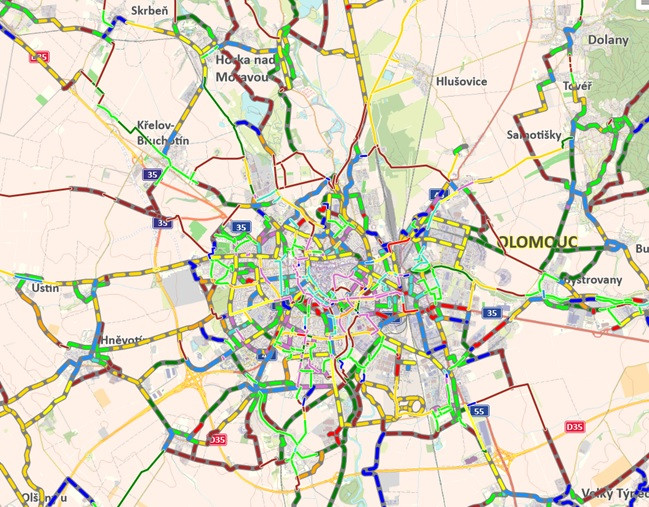 See you: stavbycyklo.cz
Design for monitored attributes - manually entered
Year of realization |
Degree of preparedness |
Planner |
Building / Joint permit issued: YES / NO |
Indicative costs |
Surface paved / unpaved |
Surface condition - satisfactory, unsatisfactory |
Width - only for cycle tracks constructed |
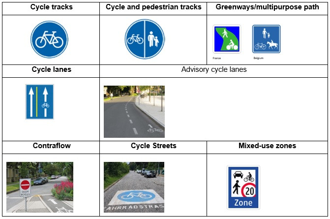
Cycle route – distinguish a long-distance network (one- and two-digit numbers), regional network (three-digit numbers), local network (four-digit numbers) |
EV Cycle route - EuroVelo |
Cycle route - prospectively re-routed |
Marking of the cycle route |
Administrator of the cycle route |
Pictures |
Current status of the construction, or a link to www.citychangers.eu where the project will be described. |
Design for monitored attributes - automatically entered
ID - polyline of the cycleway