CYKLOVIZE 2030

We help to change a cycling culture a to build safety cycling network.


We monitor the intentions of municipalities, cities, and regions for the construction of bicycle paths.
 

In cooperation with regions and cities, a map of the transport network for cyclists is being created (http://stavbycyklo.cz/

The 2030 CYKLOVIZE project is a collective effort with the goal of creating a safe transportation network that will serve not only adult cyclists, but also our seniors, children, and generations to come. We want our work today to shape a safer tomorrow. We are working together as a team to ensure that bike trails are not just lines on a map, but real routes that safely navigate cyclists, just like roads for cars or rails for trains.

A group of representatives from each region is working on the project under the auspices of the Association of Regions and the Partnership for Urban Mobility. CYKLOVIZE 2030 cooperates closely with the Working Group of the Ministry of Transport. We believe that the best results will be achieved when we join forces. And so we are building a network that is not just for today, but for days to come.

In the Czech Republic, the total length of cycle paths and other safety measures for bicycles is nearly five thousand kilometres. However, the network of transport cycle paths is also discontinuous. During the journey, users are thus exposed to dangerous situations where the cycle path leads them onto a busy road or the path ends abruptly without any continuation. The map server of the CYKLOVIZE 2030 project is gradually registering risk spots that will be removed with the support of European funds, the state budget and individual regions. The as yet discontinuous network is gradually being completed, but some important transport links between major settlements are still missing.

At the same time, it is also necessary to address sections where the construction of a separate cycle path is not possible or where it is sufficient to use, for example, forest or field paths. This will benefit cyclists, drivers and pedestrians. More cycle trails and cyclists will bring more speed to other traffic, more safety and less stress on crowded roads, which are already at capacity in many places. An overview of the systemic problems, including a proposal for solutions, can be found here .


The work follows up on the government's Concept of Urban and Active Mobility for the period 2021–2030, which was adopted in January 2021. Not only cyclists but also drivers will benefit from it. More cycle tracks means less stress on congested roads, which are no longer large enough in many places today.

There is no need to build new cycle tracks everywhere. Sometimes an agreement with a watercourse or forest manager, for example, is enough to allow cyclists to pass. Regions, cities, micro-regions register a number of conflict points, which either prevent or complicate the effort to manage cycling routes and build cycling infrastructure on land owned or managed by organizations such as the Elbe River Basin, Ohře River Basin, Vltava River Basin, Moravia River Basin, Odra River Basin, Office for representing the state in property matters, Forests of the Czech Republic, other forest administrators, etc. This is mainly due to concerns about responsibility for the safety of cyclists.

The participants in the working group also agreed that the placement of the "no entry for motor vehicles" sign (B11), which is not yet recognized by the rules to support the construction of cycle tracks, would help in many places.

A unified map will help to record, which should determine the basic network of long-distance cycling routes. The main goal is to stabilize it in the field, and to determine the transfer points between individual regions. Another task will be to divide individual long-distance cycle routes into sections according to their current and target state and to create financial instruments for its implementation. The map is currently being updated by the regions, and the outputs will be presented by the end of 2021. 


The first success - a strong team

Fulfilling the tasks that CYCLING 2030 was tasked with would not be possible without a coordinated approach of capable and passionate professionals. And such a team was formed. It is a working group composed of representatives of individual regions (each region has one cycle coordinator in it) under the auspices of the Association of Regions and the Partnership for Urban Mobility. The group is currently in the lead - although, of course, it did not avoid some initial difficulties... After all, she made her first online contacts only in May, and met for the first time on 24-25 June and the second personal meeting, planned for the Pilsen Region, took place on 11-13 October.


Map of the transport network for cyclists

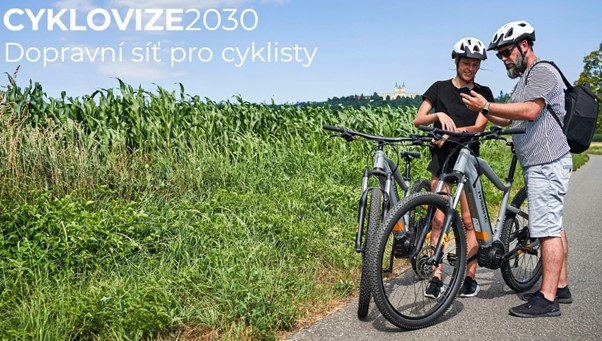
The efforts of the CYCLOVIZE 2030 working group are aimed at creating a unique map of the transport network for cyclists, which distinguishes individual sections according to their current and target state. The data for this map, including the estimated financial costs for the construction of cycle tracks, are provided by individual regions. Specifically, the working group so far:

  • Created a website that is 100% dedicated to the project.
  • Processed the data sent by the regions both in text form (plans for the construction of cycle paths on long-distance routes by 2024) and as an outline of backbone routes in GIS form. The problem here is that each region has completely different input documents, one region did not send any and the other obsolete. So everything will be fine-tuned.
  • Created the first map of the backbone cycle routes from the submitted documents and uploaded all the data to the said website. 

How do you access the data?

On the homepage of the website ("Introduction"), scroll down until you come to the Region Selection folder. Each region has its own folder, where there is two other pieces of information:

  • Text part (plans for the construction of cycle tracks on long-distance routes by 2024).
  • Outline of backbone routes in GIS form (you need to right-click on the layers you want to view).

In addition to the choice of individual regions, you also have the option of viewing the entire country.

If you jump from the "Introduction" page to the "Statistics" page, you will get summary data about the planned cycle tracks. However, these numbers will still be updated by entering data on these cycle tracks directly in the GIS.


Compliance with the government concept

CYCLOVIZE 2030 activities are carried out in accordance with the new government's Concept of Urban and Active Mobility for the period 2021–2030. There is an issue addressed in these chapters:

  • 2.3.4. Support the financing and development of infrastructure for active mobility (page 30)
  • 2.3.5. Coordination of active mobility (page 33)
  • 3.3 Financing (page 36)
  • 3.5. Involvement and role of regions (page 41)

In connection with point 2.3.5. CYCLOVIZE 2030 working group welcomed the fact that Ing. Jaroslav Martinek from the Partnership for Urban Mobility will stay the national cycling coordinator. His agenda and competencies will still be fine-tuned together with the Ministry of Transport, but the scope of work is clear from the above activities.

Youtube video
Za "url:" dosaďte kód z videa na youtube.
Například url: ScMzIvxBSi4. Tento kód získáte z URL adresy videa a je to kód umístěný za rovnítkem. Vzor: https://www.youtube.com/watch?v=ScMzIvxBSi4

Modul: Seznam podstránek


Our tasks:

  • We support the development of new cycleways.
  • We help deliver safe cycling network for everyday journeys.
  • We monitor what the towns and regions plan in the field of cycling infrastructure development.
  • A map for designing safe measures for cyclists will be created.
  • Our target is to deliver in cooperation with towns and regions a safe network for cyclists.